File:MAP - Global Seismic Hazard Map (GSHAP, 1999).jpg
From Ice Age Farmer Wiki
Size of this preview: 800 × 434 pixels. Other resolutions: 320 × 173 pixels | 640 × 347 pixels | 1,024 × 555 pixels | 1,280 × 694 pixels | 2,421 × 1,312 pixels.
Original file (2,421 × 1,312 pixels, file size: 1.18 MB, MIME type: image/jpeg)
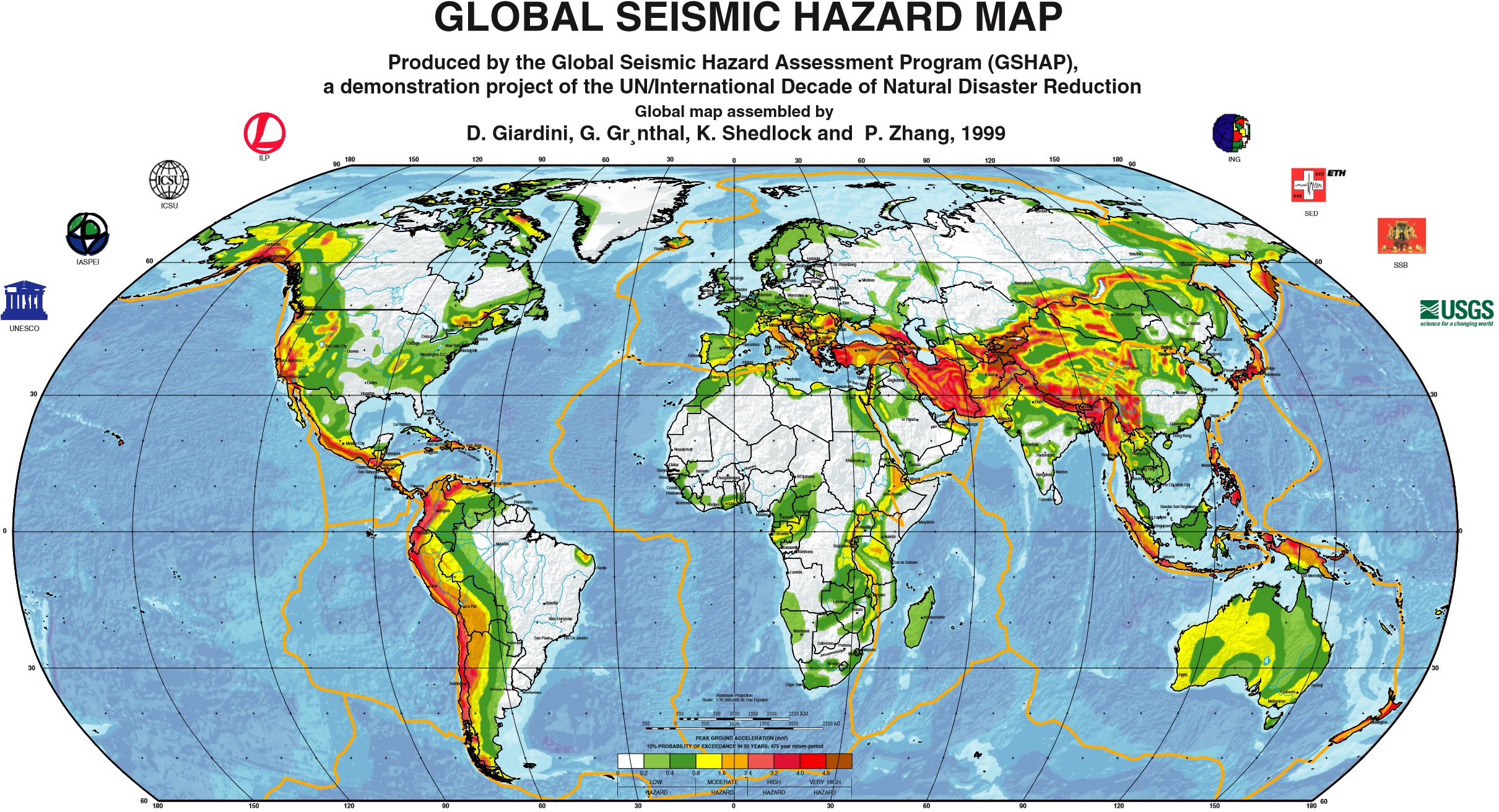
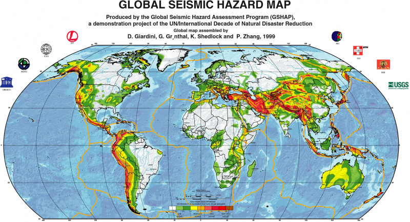
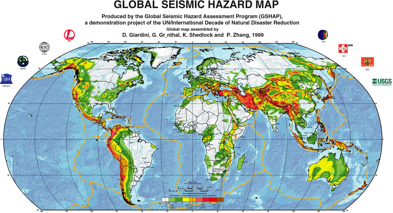
Glomap Map of Seismic Hazards from Global Seismic Hazard Assessment Program (GSHAP), 1999.
File history
Click on a date/time to view the file as it appeared at that time.
| Date/Time | Thumbnail | Dimensions | User | Comment | |
|---|---|---|---|---|---|
| current | 05:31, 4 January 2018 | | 2,421 × 1,312 (1.18 MB) | Nanomyou5 (talk | contribs) | Glomap Map of Seismic Hazards from Global Seismic Hazard Assessment Program (GSHAP), 1999. |
- You cannot overwrite this file.
File usage
The following page links to this file:
.jpg&oldid=824)
.jpg)
.jpg&action=edit&redlink=1)
.jpg&action=edit)
.jpg&action=history)
.jpg)
.jpg)
.jpg&oldid=824&printable=yes)
.jpg&oldid=824)
.jpg&action=info)